
The 15 best hiking trails in Tenerife to discover its nature
Tenerife is an ideal destination for hiking lovers. The island has a wide variety of routes that allow you to explore its unique nature and landscapes. From majestic volcanic peaks to lush forests, there are options for all skill levels. This article presents the 15 best hiking trails in Tenerife.
The network of trails in Tenerife has three types of routes: -grand trails (GR), -small trails (PR) and local trail (SL). On the web and the Tenerife On application you can consult the files of each of the routes.
that make up the network of trails of Tenerife, as well as routes for horseback riding, cycling or motor vehicles, allowing among other services to design customized routes.
- 1. Pico del Teide: The Great Adventure
- 2. Los Enigmas Forest: A Natural Refuge
- 3. Challenging the Masca Ravine
- 4. Chinyero Volcano: Volcanic History
- 5. Path of the Senses: The Awakening of the Senses
- 6. Barranco del Infierno: Exuberant Nature
- 7. Route from Chamorga to Roque Bermejo
- 8. From El Bailadero to Taganana: North View
- 9. Route from Afur to Taganana: Canarian Authenticity
- 10. Centennial Guardians: The Power of Nature
- 11. Roques de Garcia Trail: Rocky Formations
- 12. Ascent to Pico del Teide from La Rambleta
- 13. Montaña Blanca: Tranquility at High Altitude
- 14. La Caldera de Güímar: Canary Islands Geography
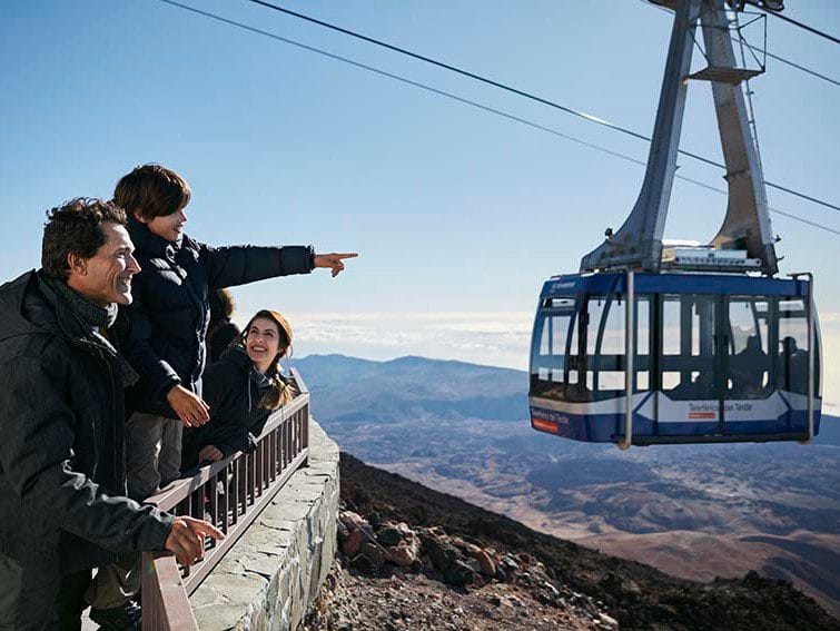
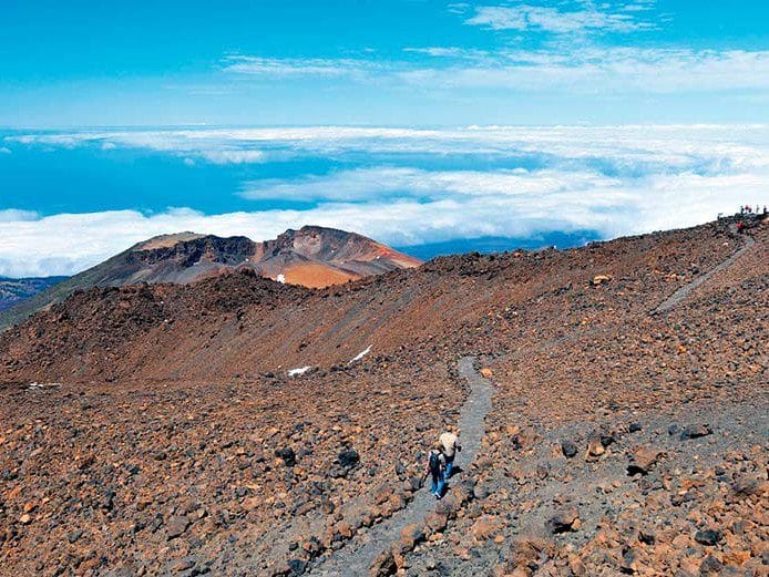
1. Pico del Teide: The Great Adventure
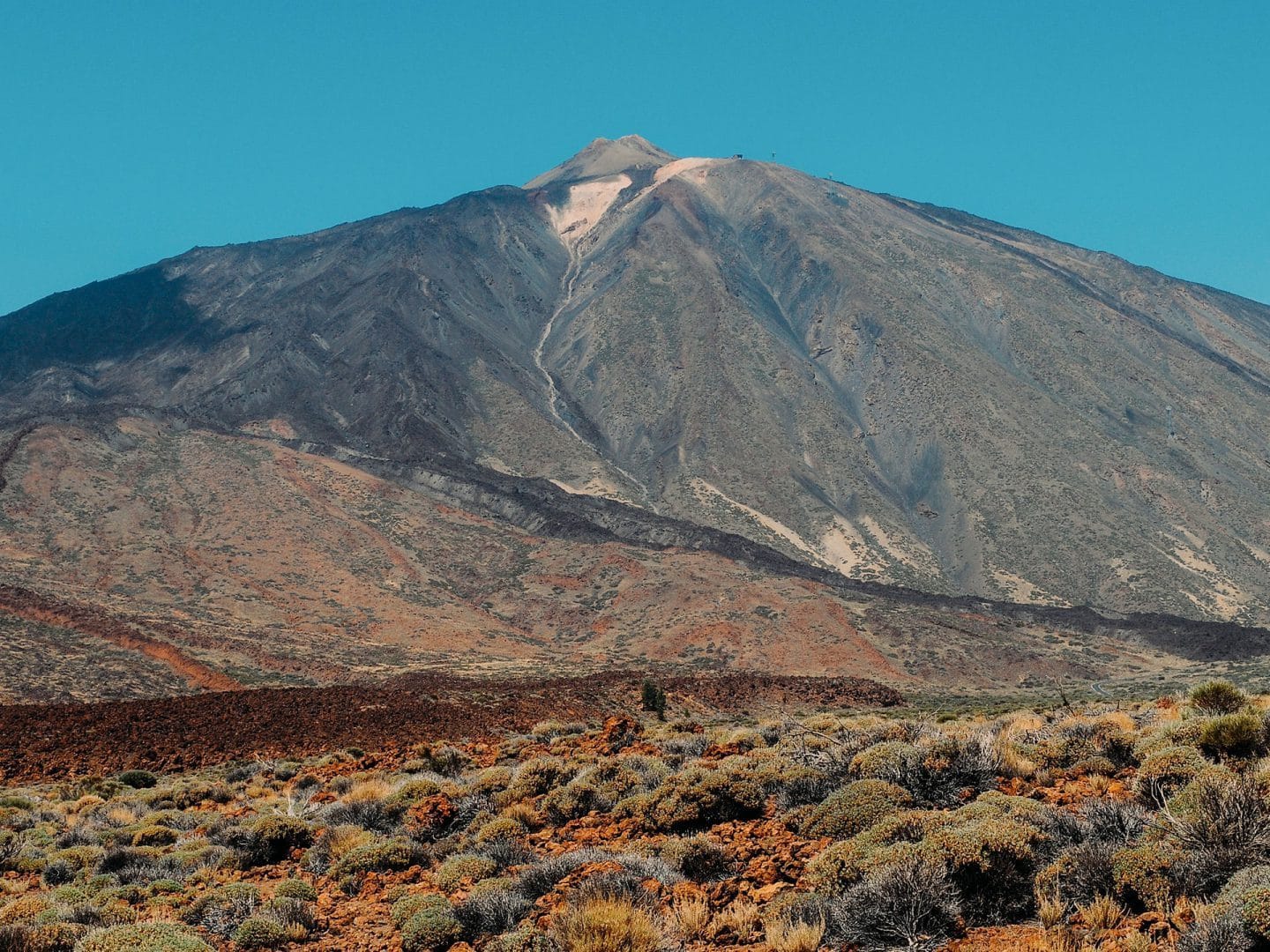
Pico del Teide, with its 3,718 meters, is the highest peak in Spain and one of the main natural wonders of Tenerife. Its majesty attracts both tourists and hiking enthusiasts. The route to Teide is undoubtedly a unique and unforgettable experience.
Promotion Options
There are several ways to tackle the ascent of Teide, each with different characteristics and difficulties. The options include:
- Trail from Montaña Blanca: This is one of the most classic routes, which offers a challenging route.
- Trail from Pico Viejo: This route is equally demanding and allows you to enjoy impressive views, being an excellent alternative for the more adventurous.
- Teide cable car: For those who wish to facilitate the ascent, taking the cable car to La Rambleta station is ideal.
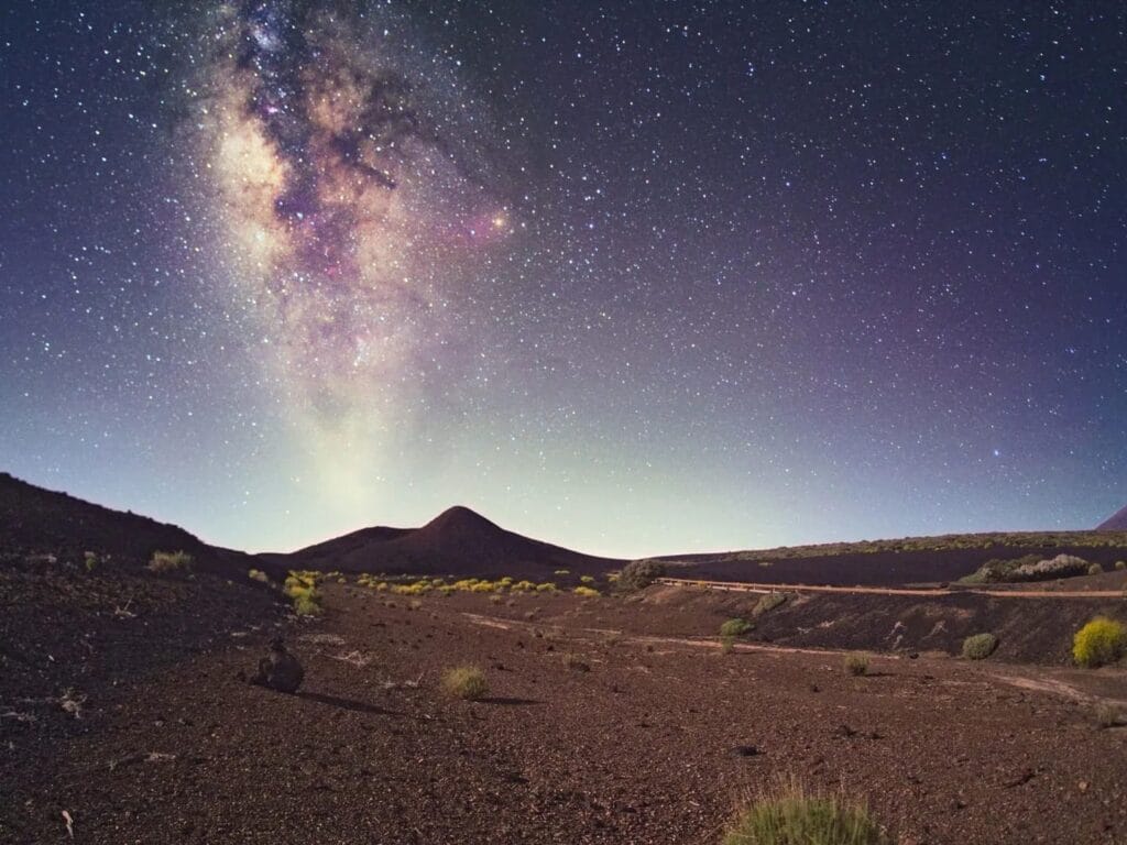
Night Experience
The experience of ascending Teide at night is simply magical. On clear nights, it is possible to observe the Milky Way in its splendor. The night route through the Cañadas allows a unique connection with nature. Without the disturbance of city lights, the sky becomes a natural spectacle.

Difficulty Considerations
The level of difficulty of the ascent to Pico del Teide is considered high, especially for the routes that are not done with the cable car. It requires a good physical condition and to be well prepared to face the route. It is crucial to carry enough water, adequate clothing and appropriate footwear. Despite the difficulty, the reward, spectacular panoramic views and the opportunity to conquer the summit, make it worth the effort.
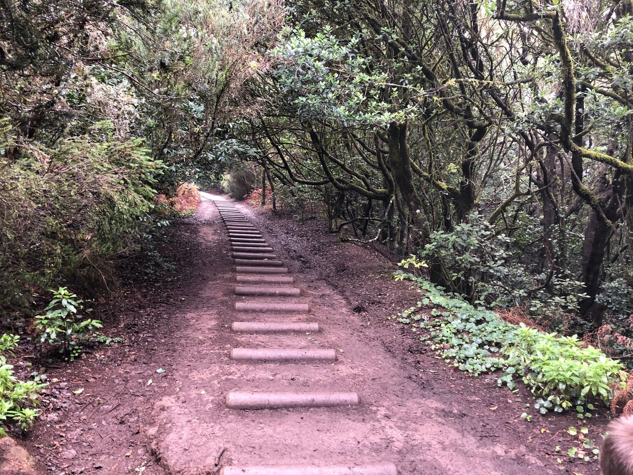
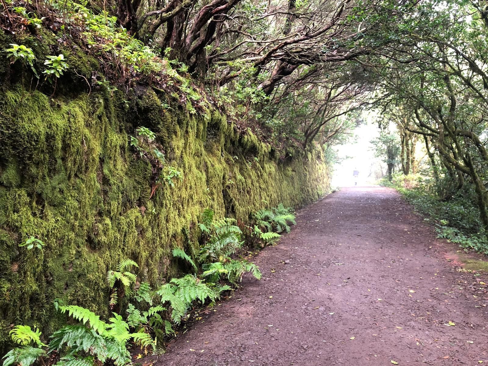
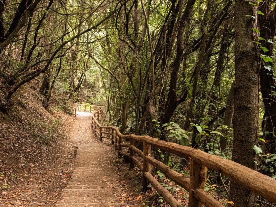
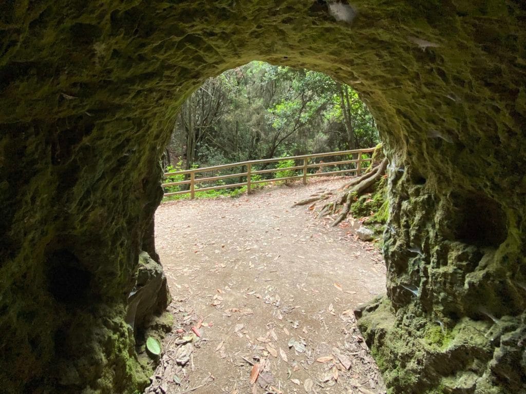
2. Bosque de Los Enigmas: A Natural Refuge
This enchanting forest, located in the Anaga Rural Park, is a magical corner where nature offers a spectacle of beauty. With its abundant vegetation, it becomes an ideal place for those who want to disconnect and enjoy the fresh air.
Itinerary and Signage
The tour begins at the Zapata or Cruz del Carmen viewpoint, both starting points are well marked. As you advance, the trail presents different forks that allow you to explore the area. It is essential to follow the indications to enjoy a safe and uncomplicated hike.
The 5-kilometer circular trail is well maintained, which facilitates its accessibility. With an estimated travel time of about two hours, hikers can enjoy the tranquility of the forest without physical overload.
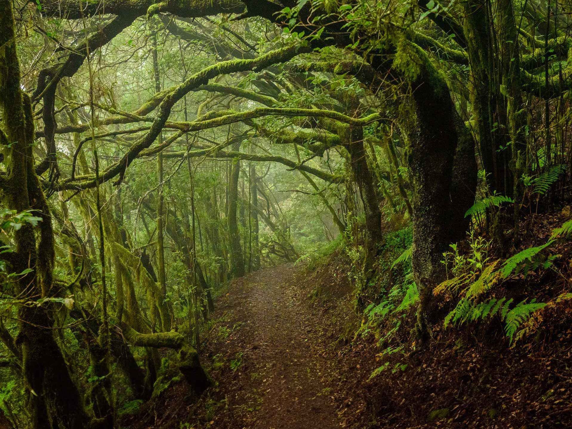
Laurisilva Flora
The Bosque de Los Enigmas is a refuge for laurisilva, a type of vegetation that develops in humid and temperate zones. The lush trees, such as laurel and linden, provide shade and a special microclimate that favors the growth of various species.
- Much of the flora is endemic, meaning that many plants are found nowhere else in the world.
- Ferns, mosses and lichens add a touch of vibrant green, accompanying the trees and bringing the landscape to life.
Recommendations for Beginners
For those who are new to hiking, the Bosque de Los Enigmas is an excellent option. The route is of low difficulty, ideal for all levels of experience. It is suggested to bring appropriate footwear, as well as water and a hat to protect you from the sun.
- It is advisable to visit the forest on clear days to enjoy the panoramic views.
- Families and groups of friends will find in this route a place to enjoy nature in a safe and friendly environment.
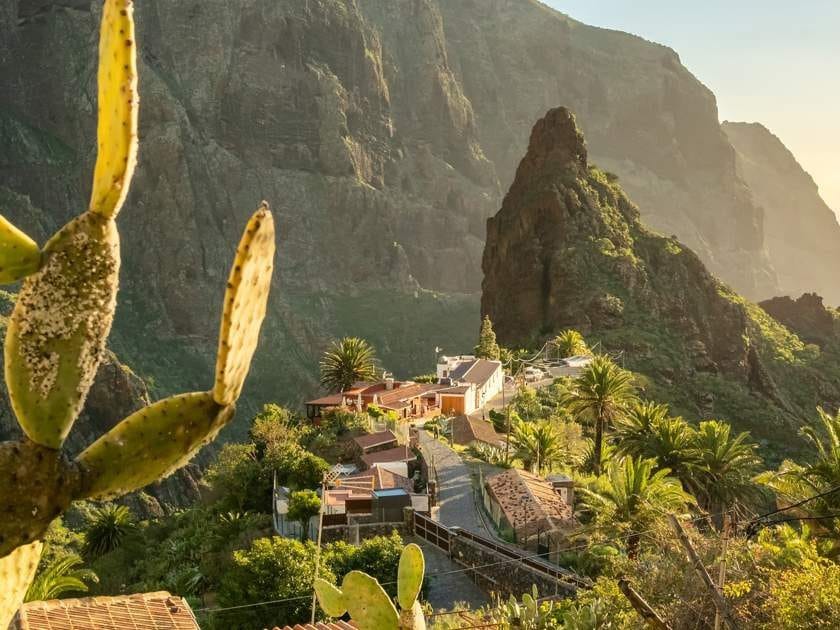
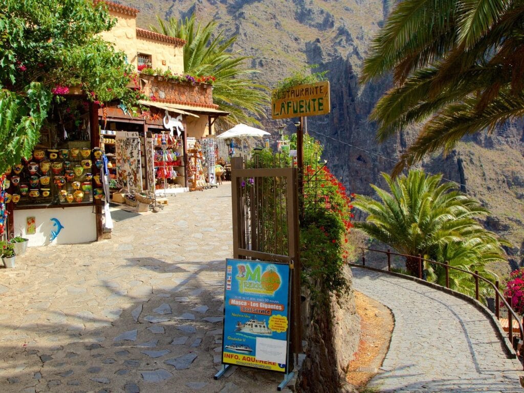
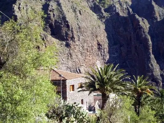
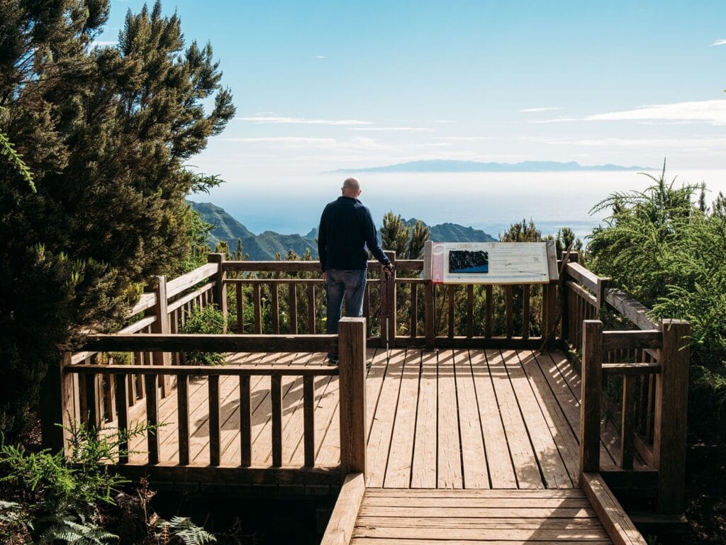
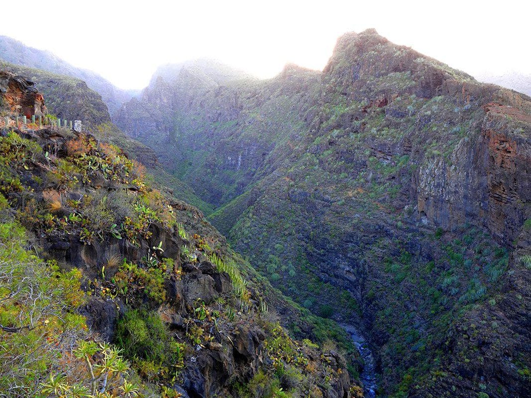
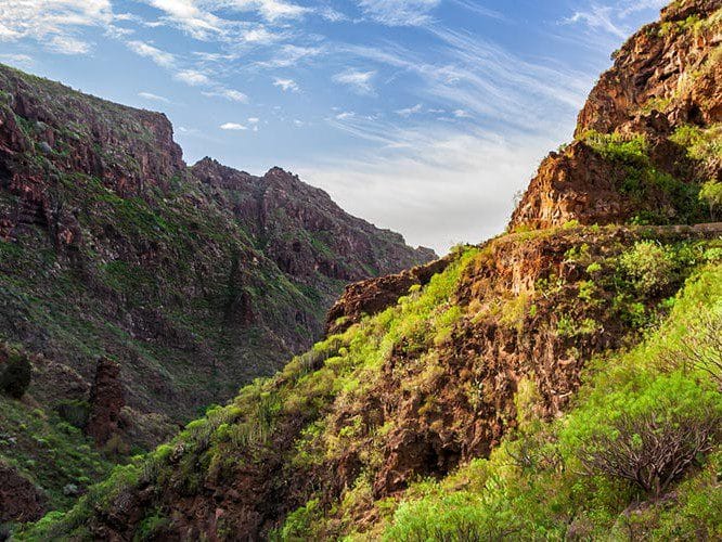
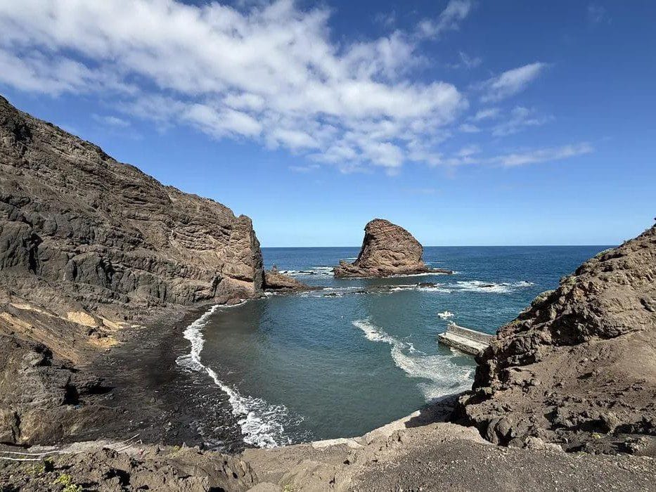
3. Challenging the Masca Ravine
This impressive ravine, located in the northwest of Tenerife, is known for its spectacular views and unspoiled nature. It attracts many hikers looking for a physical challenge and a unique visual experience.
Access and Permissions
Getting to Barranco de Masca is a simple process. It can be accessed by car up to the small village of Masca, where the route begins. However, it is vital to note that a special permit from the Teno Rural Park is required to descend the ravine. These permits can be obtained online or at the entrance of the trail, and it is crucial to process it in advance due to the limited number of daily visitors.
Guided Tour: Advantages
Opting for a guided tour is highly recommended. Local guides not only know the trail, but also offer valuable information about the flora, fauna and geology of the area. Thus, hikers can enjoy a more enriching context while exploring the landscape. Guided routes often include transfers and some even offer refreshments, making the experience easier without logistical worries.
Safety Tips
Safety in the Barranco de Masca is paramount, since it is a demanding trail with complicated sections. It is advisable to wear appropriate clothing and footwear, as the terrain can be slippery and steep. It is also important to bring enough water, some food and a cell phone. The signage is good, but it is always advisable to carry a map or use hiking apps. During the hike, it is essential to pay attention to the weather, as conditions can change quickly in the mountains. It is not advisable to do this hike on rainy days, due to the risk of landslides.
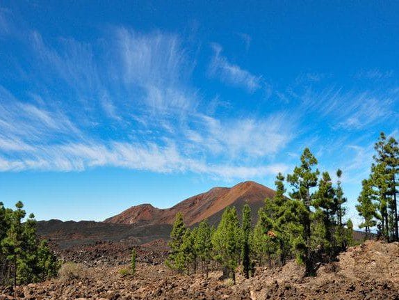
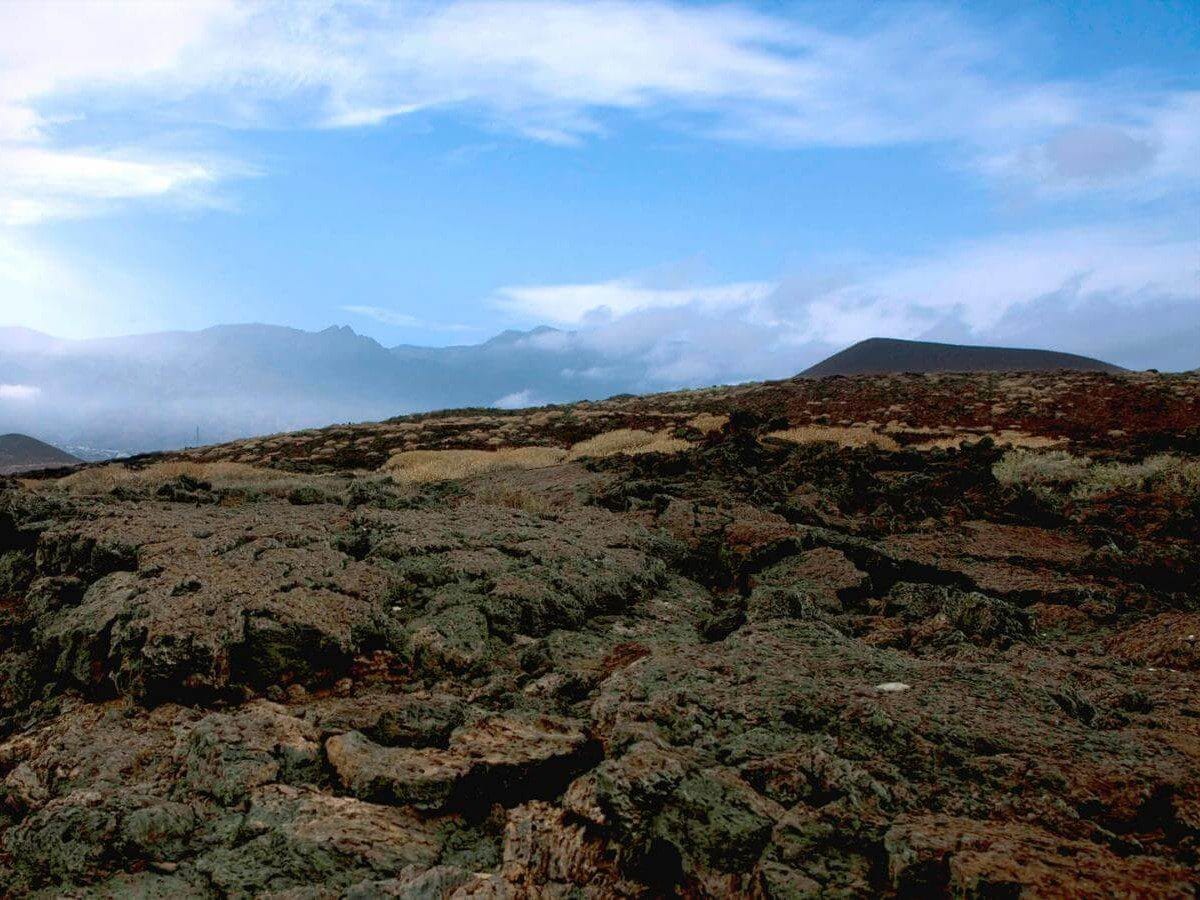
4. Chinyero Volcano: Volcanic History
The Chinyero Volcano, located in the northwest of Tenerife, is a testimony to the geological history of the island. Its last eruption occurred in 1909, making it one of the most recent volcanoes in the region. This place is perfect for exploring the fascinating nature surrounding the traces left by volcanic activity.
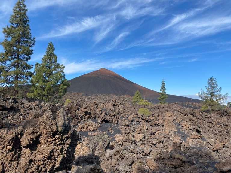
Path and Distance
The route around the Chinyero Volcano offers a circular trail of approximately 4 kilometers in length. It can be completed in an estimated time of 2 to 3 hours, depending on the hiker’s pace. The trail is well marked, which makes it easy to follow and ensures a pleasant experience for hikers.
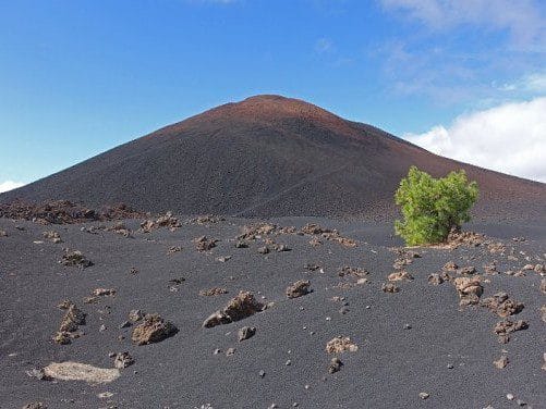
Landscape and Biodiversity
The landscape of Chinyero is impressive, combining lava flows and a wooded environment that includes Canary Island pines. The biodiversity is remarkable, showing the recovery of flora after the eruption. Visitors find a variety of plant species, as well as fauna inhabiting this volcanic region. Among the plants are:
- Pines of the Canary Islands.
- Retamas.
- Cactus of various types.
The different strata of lava form a visual contrast with the surrounding greenery, providing ideal opportunities for photography and natural observation.
Photographic Observations
The Chinyero Volcano is not only a destination for hikers, but also a photographer’s paradise. The variety of textures, colors and shapes of the volcanic landscape presents numerous points of interest to capture. It is advisable to make use of natural light at sunrise or sunset for stunning images. Some aspects to keep in mind include:
- The texture of the lava flows.
- The rock formations contrasting with the sky.
- The surrounding flora that adds color to the landscape.
5. Path of the Senses: The Awakening of the Senses
This trail, located in the Anaga Rural Park, is designed so that visitors can connect with nature in a unique way. Through a series of sensory elements, visitors are invited to explore the beauty of the natural environment.
Amenities and Accessibility
The Path of the Senses stands out for being accessible to all people, including those with reduced mobility. Throughout the hike, several facilities have been provided to ensure a comfortable and enriching experience. Amenities include:
- Adapted and well marked trails.
- Resting points at strategic locations.
- Information areas with data on local flora and fauna.
This transforms the route into an inclusive space where everyone can enjoy contact with nature, turning the adventure into a complete sensory experience.
Alternative Routes
For those looking to diversify their experience, the Sendero de los Sentidos offers several equally fascinating alternative routes. These options allow you to enjoy different aspects of the Anaga Rural Park, including:
- Longer trails enrich the experience with panoramic ocean views.
- Trails that pass through denser areas of laurel forest, perfect for botany lovers.
- Interactive routes that include stops with activities to stimulate the senses.
Exploring these alternatives offers not only a physical challenge, but also the opportunity to delve into Tenerife’s biodiversity and culture, making each visit unique and memorable.
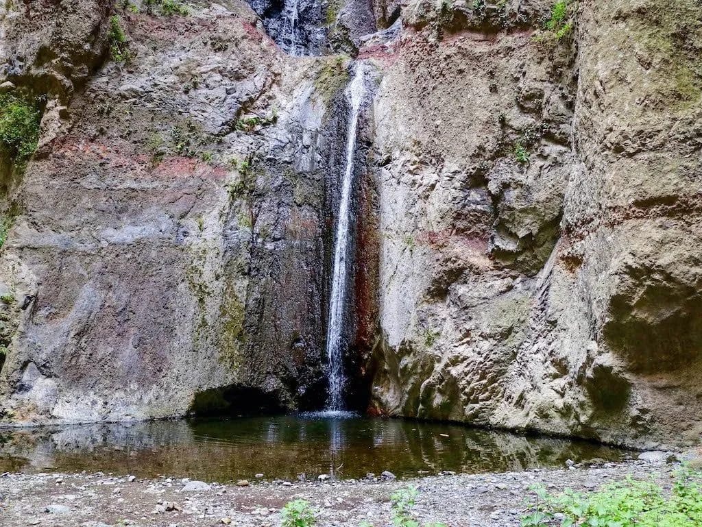
6. Barranco del Infierno: Exuberant Nature
This dazzling natural spot is located in the south of Tenerife, offering an environment full of vegetation and an impressive scenic spectacle. The Barranco del Infierno is perfect for those looking for a close contact with the flora and fauna of the island.
Permits Required
To access the Barranco del Infierno, it is essential to request a permit. This measure is implemented to protect the natural environment of the area, thus controlling the flow of visitors. Permits can be obtained at the trail entrance and are subject to a daily limit, so it is advisable to plan your visit in advance.
Flora and Fauna
The Barranco del Infierno is home to a rich biodiversity that includes native species of flora and fauna. During the tour, you can observe:
- Vegetation: Laurisilva, Canary Island pines, and a variety of succulent plants adapted to the conditions of the ravine.
- Fauna: Endemic birds such as the blue finch and small reptiles that inhabit the arboreal environment.
The combination of these species generates a unique ecosystem, ideal for the study and observation of nature.
Highlights
The Barranco del Infierno trail is known for several points of interest that enrich the hiking experience. Among them are:
- Waterfall: The waterfall of the ravine is one of the main attractions, offering an impressive visual spectacle, especially after the rains.
- Viewpoints: Along the route there are several viewpoints that allow you to enjoy panoramic views of the surrounding landscape, ideal for photographs.
- Picnic area: A place to rest and enjoy a snack in a natural environment.
The combination of these elements makes Barranco del Infierno an exceptional place to explore the exuberant nature of Tenerife.
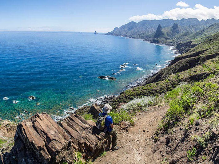
7. Route from Chamorga to Roque Bermejo
This trail offers a unique experience in Tenerife, connecting two picturesque villages. The trail is full of natural beauty and breathtaking views of the ocean, ideal for those looking to enjoy an authentic and traditional environment.
Spectacular Landscapes
The route between Chamorga and Roque Bermejo presents one of the most beautiful landscapes of the island. Dramatic cliffs, rock formations and exuberant vegetation can be observed as you go along. Hikers will be able to admire:
- Mountains that seem to touch the sky.
- Native vegetation with a great ecological value.
- Panoramic views that include the Atlantic Ocean and the green valleys of Tenerife.
The diversity of ecosystems on this route provides a captivating visual experience, especially on sunny days when the sea shines brightly.
Seasons and Weather
The route from Chamorga to Roque Bermejo can be enjoyed in different seasons, each offering its own magic. Spring, with its explosion of colorful flowers, is ideal for walking. In summer, the warm weather allows you to hike the trail during the hours of sunrise or sunset, when the sun paints the horizon with golden tones. Autumn is perfect for enjoying the fresh air and tranquility, while in winter, it can be colder, but the route is still accessible. It is recommended to bring adequate clothing for temperature variations and possible rain.
Travel Tips
For a safe and pleasant experience while hiking, it is essential to take into account certain aspects. The following tips are suggested:
- Carry enough water and energy snacks to maintain energy.
- Wear appropriate footwear that offers good support.
- Check the weather before leaving and be prepared for rapid changes.
- Inform someone about the route and the expected duration of the hike.
- Respect the local flora and fauna, avoiding any type of alteration of the environment.
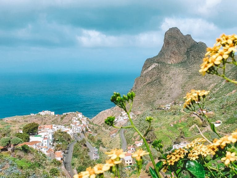
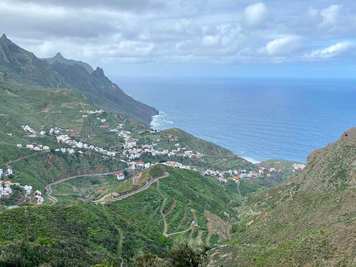
8. From El Bailadero to Taganana: North View
The route from El Bailadero to Taganana reveals amazing landscapes in the north of Tenerife. Strolling along this trail allows you to enjoy panoramic views that combine mountains and ocean, providing a captivating natural environment.
Accessibility for Families
This trail is characterized by its accessibility, which makes it a perfect option for families with children. Most of the sections are easy to walk, which allows you to enjoy a rewarding experience without excessive physical difficulty. A baby stroller is recommended in certain areas, although some parts are ideal for walking on foot. There are also places to rest and enjoy a family picnic along the way.
Recommended Alternate Routes
Hikers looking to explore beyond the main route may consider the following alternative options:
- Camino de Taganana: A trail that connects directly to the village of Taganana and offers equally impressive views, ideal for those who wish to extend their adventure.
- Benijo Beach Trail: This trail leads to the coast, offering the opportunity to combine hiking with a moment of rest on one of the most beautiful beaches on the island.
- Ruta de los Senderos de Anaga: A longer route that allows you to explore several trails in the Anaga Rural Park, known for its spectacular biodiversity and landscapes.
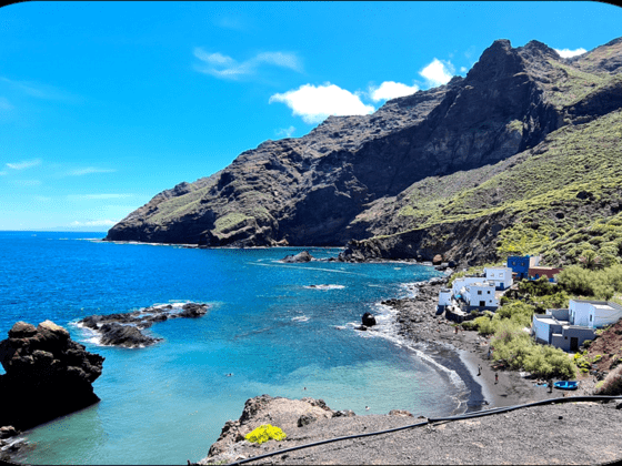
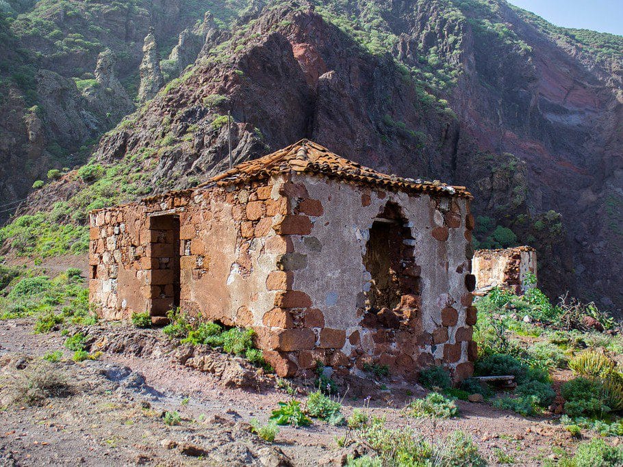
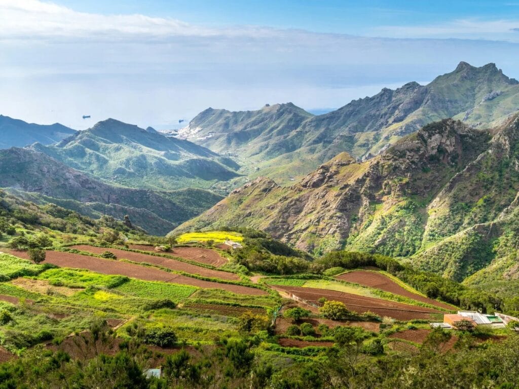
9. Route from Afur to Taganana: Canarian Authenticity
The route from Afur to Taganana is a route that connects two beautiful villages in the north of Tenerife. This trail provides the opportunity to immerse yourself in the local culture and enjoy beautiful Canarian landscapes.
Local Traditions
During the journey, it is possible to appreciate various traditions that are still alive in the community. The inhabitants of Taganana are known for their convent life and their dedication to agriculture. Customs such as traditional agriculture and the elaboration of local products are present in every corner of the road.
- Handicrafts: Along the way you can find artisans who make typical products, such as wicker baskets and textiles.
- Festivals: Celebrations such as patron saint festivals are key moments in the local culture, where you can listen to popular songs and enjoy typical dances.
Gastronomy on the Camino
As the route progresses, the gastronomy of the Canary Islands is an undeniable attraction. Hikers can delight in dishes that reflect the island’s rich culinary history. From traditional stews to fresh seafood, the gastronomic experience is unparalleled.
- Papas arrugadas: Accompanied by mojo, they are a fundamental dish in the Canarian diet.
- Fresh fish: Taganana, being a fishing village, offers delicious fish dishes that stand out for their freshness.
- Local wines: The area is also known for its wineries, where you can taste sweet and white wine characteristic of the region.
10. Centennial Guardians: The Power of Nature
This route stands out for its impressive specimens of ancient flora, associated with the island's unique biodiversity. The ancient trees and plants that inhabit the trail tell stories of resilience and adaptation to a changing environment.
Ancient Flora
On this trail, hikers will encounter a variety of plant species that have survived over the centuries. The laurel forest, characteristic of the region, is a clear example of flora that has thrived due to its unique climatic conditions. Some of the highlights include:
- Canary Island pines, which add a distinctive touch to the landscape.
- Endemic species such as the dragon tree, a tree that symbolizes the natural wealth of Tenerife.
- Numerous species of lichens and mosses create a vibrant and healthy environment.
Observing these centuries-old trees provides a better understanding of the island’s ecological history. Their longevity highlights the importance of preserving these spaces and the richness they bring to the local ecosystem.
Nature Photography
The Centennial Guardians trail is a true paradise for nature photography lovers. The light conditions and variability of the landscape offer unique opportunities to capture the beauty of the flora and fauna. Some of the best moments to shoot include:
- The early morning hours, when the sunlight penetrates through the treetops.
- The sunset, which provides a magnificent contrast with the green tones of the vegetation.
- Recent rains, which bring out the colors and textures of the leaves and flowers.
11. Roques de Garcia Trail: Rocky Formations
The Roques de García Trail stands out for its majestic geological formations, offering a unique perspective of the Teide National Park. This route is ideal for nature and photography lovers, as it combines breathtaking landscapes with a diverse environment.
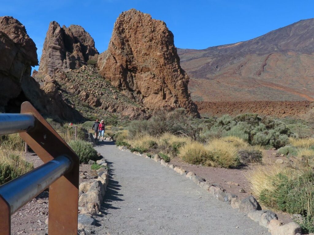
Teide view
The trail offers panoramic views of the iconic Pico del Teide, the highest point in Spain. Along the trail, hikers can enjoy different perspectives of the mountain and its volcanic surroundings. The views are especially captivating from the established viewpoints, which allow you to appreciate the majesty of this environment.
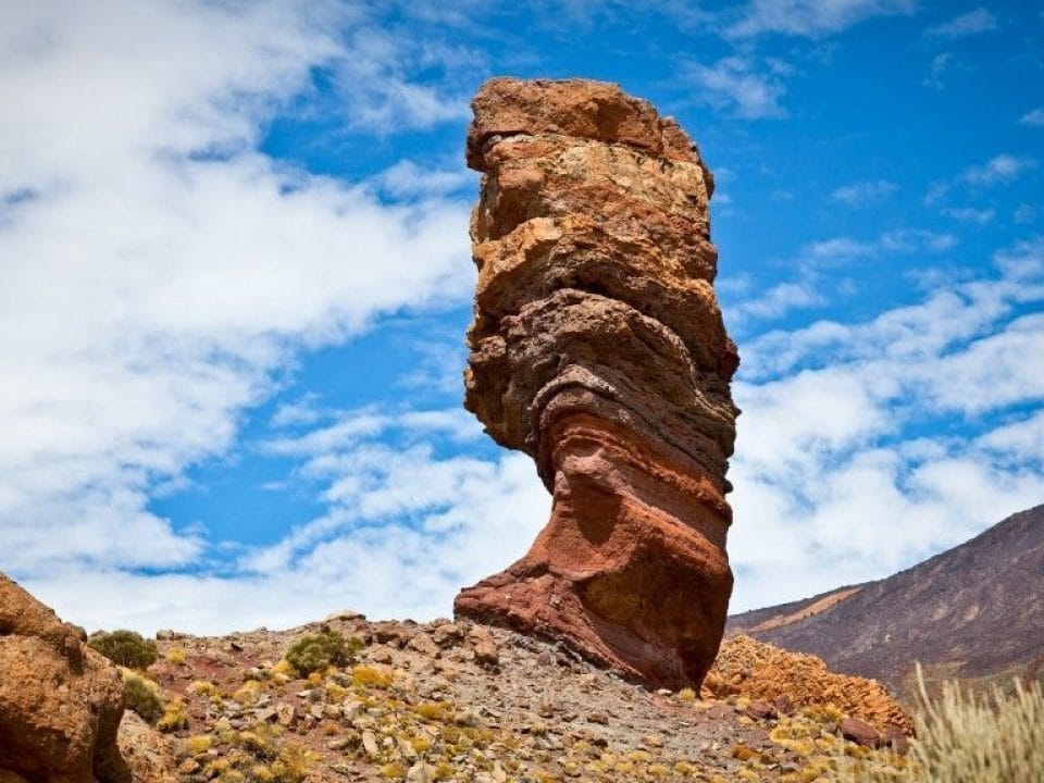
Impressive Photographs
The scenery surrounding the trail is second to none for photography enthusiasts. Some recommendations on what to capture are:
- Rock formations of Roque de García, which serve as a dramatic backdrop.
- The color contrasts between the rocks and the sky, especially at sunrise or sunset.
- The local flora, which adds vibrant hues to the images.
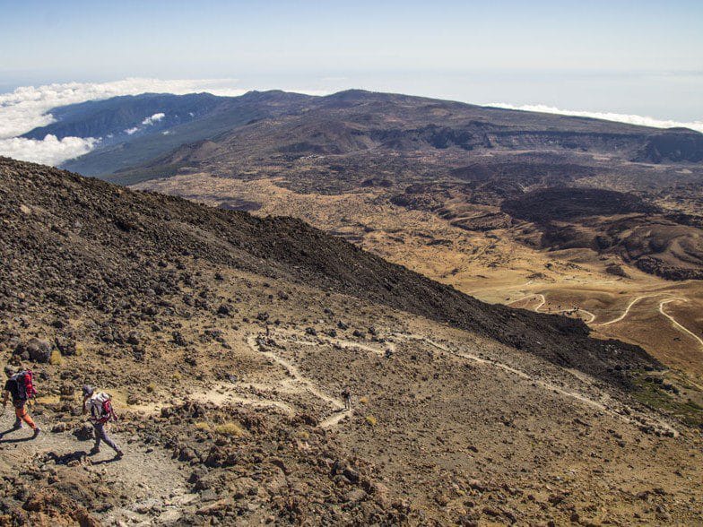
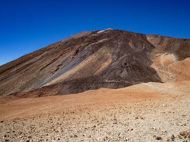
12. Ascent to Pico del Teide from La Rambleta
This route is one of the most popular ways to reach the summit of Teide, the highest peak in Spain. From La Rambleta, at 3,555 meters, hikers can enjoy a route that combines natural beauty with the thrill of reaching the summit.
Obtaining Permits
To climb Pico del Teide from La Rambleta, it is necessary to obtain a permit that regulates access to the summit. This permit can be managed through the official website of the Government of the Canary Islands. It is advisable to do so in advance, especially during the high tourist season, when demand increases significantly. The reservation of the permit ensures that the natural environment remains protected and that crowds at the summit are avoided.
Ascension Tips
The ascent to the peak presents some difficulties that hikers should be aware of. It is crucial to be well prepared, both physically and mentally, to face the altitude and terrain. The following recommendations are suggested:
- Warm up properly before starting the route.
- Wear appropriate clothing, as the temperature can vary drastically.
- Carry enough water and energy snacks to maintain your energy level during the ascent.
- Wear appropriate footwear, preferably hiking boots that offer good grip.
- Make sure your camera is ready to capture breathtaking views along the way.
13. Montaña Blanca: Tranquility at High Altitude
Montaña Blanca stands as one of the least crowded routes in Tenerife, providing hikers a space to enjoy nature in a more relaxed environment. Its beauty and tranquility make it a hidden gem on the island.
Less Frequent Experience
This trail stands out for its low traffic, which allows you to connect with nature in a more intimate way. When walking this trail, it is possible to enjoy breathtaking views without the frequent hustle and bustle of other more popular places. The tranquility offered by Montaña Blanca can be fully enjoyed while the sounds of the local fauna accompany each step.
Impact of Climate on the Route
The weather in the White Mountains can be unpredictable, varying from sunny days to periods of fog. This presents both a challenge and a unique experience, as the landscape changes dramatically. Some key points to consider about the weather are:
- Cool temperatures, especially at higher altitudes during the nights.
- The probability of rain may increase, especially in the winter months.
- Weather conditions can influence visibility, affecting the perception of the landscape.
14. La Caldera de Güímar: Canary Islands Geography
Located in the eastern part of Tenerife, the Caldera de Güímar is an impressive geographical feature that reflects the natural history of the island. Its volcanic formation and biodiversity add incalculable value to the Canary Island landscape.
Geological History
The Caldera de Güímar was formed through several volcanic processes that have shaped Tenerife. This natural enclosure is the result of ancient eruptions and time-related erosion. It is estimated that its origin dates back to millions of years ago, when volcanic activity was prominent in the region.
Its current structure is characterized by high walls and considerable depth, offering a refuge for various species. The layers of lava, along with the remains of ancient eruptions, tell the story of the formation of the island, making this place a real window to the geological past of Tenerife.
Distinctive Natural Elements
The Caldera de Güímar is an area rich in flora and fauna. Among its most distinctive elements are:
- Endemic fauna, such as birds and reptiles that have found a favorable habitat in this area.
- The typical vegetation of the laurel forest, which includes species such as laurel and heather, creating a unique ecosystem.
- Singular rock formations, which are the result of the interaction between lava and water, modeling the landscape in a peculiar way.